![]() Antiquarian Books, Maps, Prints & Photographs - I
Antiquarian Books, Maps, Prints & Photographs - I
![]() Antiquarian Books, Maps, Prints & Photographs - I
RICHARD BARRON
Antiquarian Books, Maps, Prints & Photographs - I
RICHARD BARRON
CONTACT US
Catalogue & Viewing
Lot Closed
Accounts & Shipping
Lot Closed
-
Details
 Details
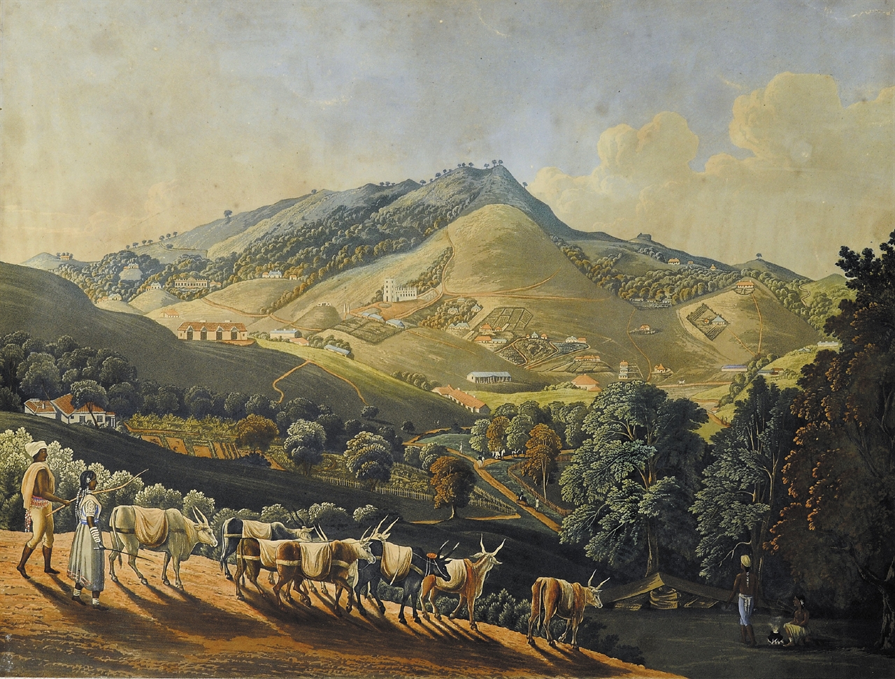
General view of OOTACAMUND (Nilgiri Hills) A very fine and rare hand colored aquatint by Robert Havell Junior after Richard Barron. Showing the range of mountains with local Todas grazing the Cows. In the foreground with few British Residence in the distant background. London, 1837.double mounted, glazed and framed.
-
Literature
 Literature

Richard Barron ( died 1838)
While Simla was developing as a hill–station in the north, the British were also creating a resort at Ootacamund in the Nilgiri Hills. The principal attraction, besides its forests, waterfalls and climate, reminiscent of England, was a lake. Ootacamund soon became a retreate for the Governor of Madras and his staff. Captain Richard Barron (of the 3rd East Kent Regiment) was appointed aide–de–camp to Sir Frederick Adam, the Governor of Madras, in 1834. The following year, Barron visited Ootacamund, he made sketches and observations on the locality.
Six of Barron’s panoramic scenes of the Ootacamund environs were engraved in aquatint and also published by Robert Havell junior in London in 1837. The set, entitled Views in India, chiefly among the Neelgherry Hills conveys the character of the countryside in brilliant sunlight. Barron described the experience on arriving at Ootacamund:
“This view comes suddenly on the stranger coming up from the low country at one moment, and while stationery, after ascending from the plains of Coimbatoor, he beholds a little European colony of cottages, beautifully dispersed on the nobs of hills, and almost in the woods. The figures in the foreground are the Bringarries [Banjaras], who principally supply the Cantonment with grain, and are, in costume, a Spannish–like looking people.”
In the preface Barron also observed: “The group of hills called the Neelgherries may be considered as the Southern termination of the Western Ghauts, which at this place end in abrupt, lofty, and almost vertical precipices; the extensive valley of Coimbatore, dividing them from the Paulghaut [Palghat] chain, which in the same direction as the Ghauts [Ghats], extends down to Cape Comorin…The Neelgherries being the highest hills in the whole of the Penninsula, South of Himalaya, possess a greater degree of geological interest than any other group in this extensive region.”
The two mountain systems of the Eastern and the Western Ghats, enclosing the Deccan plateau, unite near Cape Comorin. The Western Ghats, which rise abruptly from the coastline, extend about 800 miles from the River Tapti southwards to the Malabar Coast. The flat summits of these mountains and their stepped formation have earned the entire range the title of Western Ghats.
