Antiquarian Books, Maps, Prints & Photographs - I
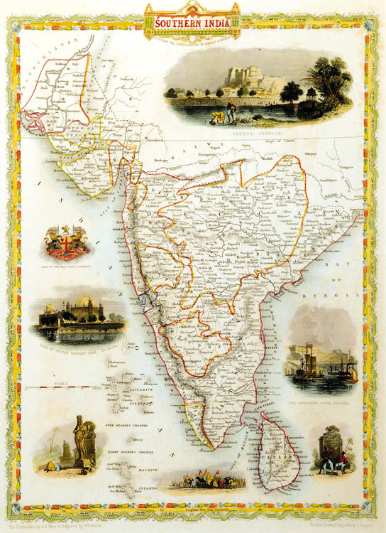
JOHN TALLIS (1816 - 1876)
CONTACT US
Catalogue & Viewing
Lot Closed
Accounts & Shipping
Lot Closed
-
Details
Details
Southern India,Tallis, J & F. London, & New York, 1851 [ca. 32 x 23 cm] Steel engraving, hand colored in outline and wash. In excellent condition. Depicting Suhur Jeypore, Tomb of Mohamed Shah,Bejjapore and the Govt House Calcutta along with the Seal of East India Company. A very decorative and colorful map of Southern India. Mounted.
-
Literature
Literature
John Tallis and Company (fl. 19th century )
John Tallis and Company published views, maps and Atlases in London from roughly 1838 to 1851. The principal works, expanding upon the earlier works of Cary and Arrowsmith, include an 1838 collection of London Street Views and the 1849 Illustrated Atlas of the World. His principle engraver was John Rapkin, whose name and decorative vignettes appear on most Tallis & Co. maps. Due to the decorative style of Rapkin's work, many regard Tallis maps as the last bastion of English decorative cartography in the 19th century. Though most Tallis maps were originally issued uncolored, it was not uncommon for 19th century libraries to commission colorists to “complete” the atlas. The London Printing and publishing Company of London and New York bought the rights for many Tallis maps in 1850 and continued Publishing his Illustrated Atlas of the World until the mid 1850s. Specific Tallis maps later appeared in innumerable mid to late 19th century publications as illustrations and appendices.