![]() Antiquarian Books, Maps, Prints & Photographs - I
Antiquarian Books, Maps, Prints & Photographs - I
![]() Antiquarian Books, Maps, Prints & Photographs - I
A.J.JOHNSON
Antiquarian Books, Maps, Prints & Photographs - I
A.J.JOHNSON
CONTACT US
Catalogue & Viewing
Lot Closed
Accounts & Shipping
Lot Closed
-
Details
 Details
Map of Asia Showing its Gt. Political Divisions, and also the various Routes of Travel Between London & India, China & Japan & C. Entered according to the act Congress in the year 1860 by S. Augustus Mitchell, Jr. in the Clerk office of the District Court of the U.S. for the eastern District of Pennsylvania A beautiful example of S. A. Mitchell Jr.’s 1864 map of the India, One of the most attractive American atlas maps of this region to appear in the mid 19th century. Features the floral border typical of Mitchell maps from the 1860–65 period.
-
Literature
 Literature

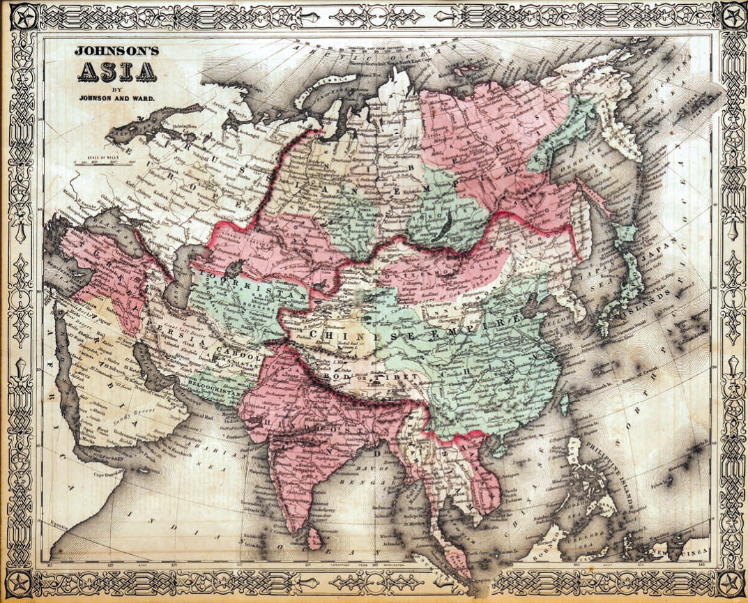
A very nice example of A. J. Johnson's 1862 map of Asia. Covers from the Arabian Peninsula and Turkey eastward as far as Kamchatka, Japan, the Philippines and New Guinea. Shows the Empires if Hindoostan (India), China (includes Tibet), Toorkistan, Persia (Iran), Cabool, Beloochistan (Afghanistan), Birma (Burma), Siam (Thailand), Anam (Vietnam), Malaysia, Japan, etc. Features the strap work style border common to Johnson’s atlas work from 1862 to 1863. Published by A.J. Johnson and Ward as plate number 87 in the 1862 edition of Johnson’s new illustrated family Atlas. This is the first edition of the Family Atlas to bear the Johnson and Ward imprint.
